
Ulleungdo: Korea's Ferry-Only Volcanic Island Guide
Tap a heading to read that section.
There's still no airport
Most Korean islands worth visiting have a flight option by now, which makes Ulleungdo an outlier: construction on its first airport only started in 2020 and it isn't expected to open until 2027. Until then, a ferry is the only way in — there's no bridge, no flight, no alternative. That single fact shapes almost everything else about visiting: you're committing to a sea crossing in both directions, on a schedule that can be cancelled by weather, so building slack into your itinerary matters more here than on almost any other Korean destination.
A volcano you're standing on top of
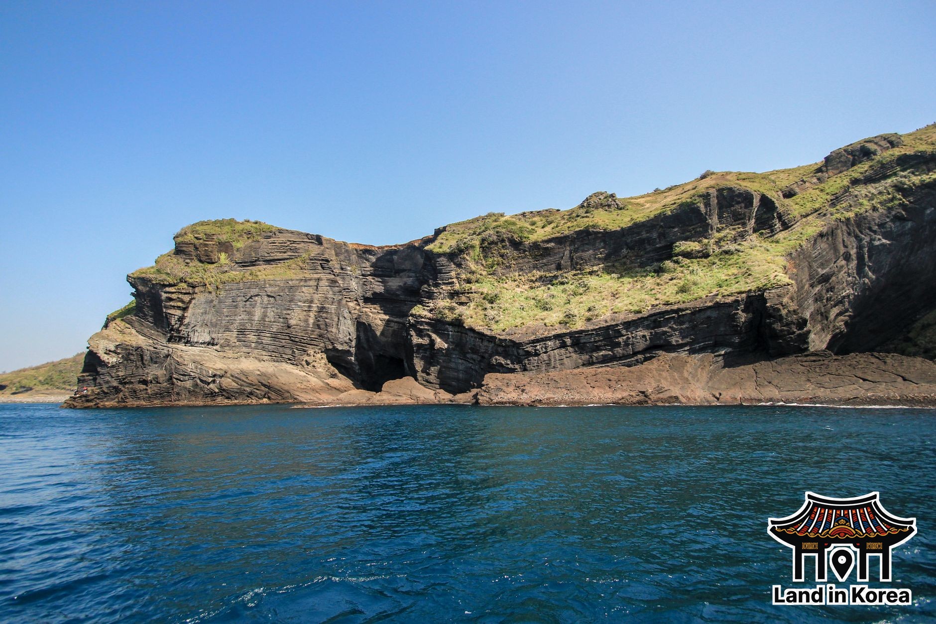
Ulleungdo is the exposed summit of a large stratovolcano rising from the sea floor, which is why the island's interior looks nothing like a flat coastal landform — Seonginbong Peak, the high point, reaches 984 meters, and the Nari Basin, a volcanic caldera floor, is the only genuinely flat ground on the entire island. The island covers about 73 square kilometers and forms the bulk of Ulleung County in North Gyeongsang Province. Dodong, the main town and ferry port, is where almost every visitor starts and ends their trip.
Getting there by ferry
Ferries run from two main mainland departure points: Pohang, with a crossing of roughly two hours fifty minutes, and Mukho (in Donghae), at around two hours forty minutes. Schedules and exact fares vary by route, season, and operator, and third-party booking sites disagree on specifics, so confirm the current timetable and price directly with the ferry operator or a booking platform before you commit to dates — this isn't a route where you want to guess and show up. Rough seas cancel sailings with little warning, so if your trip has a hard return deadline (a flight home, for instance), padding an extra day on either end is a reasonable precaution rather than overcaution.
What there actually is to do
Hiking is the headline activity — Seonginbong's trails are the main draw for visitors who come specifically for the volcano rather than just the ferry novelty. Most visitors also take one of the roughly three-hour sightseeing boat circuits that depart from Dodong, tracing the coastline and passing the smaller offshore island of Jukdo. On land, Bongnae Waterfall and a natural "icehouse" (a geological cold-air formation, not a built structure) round out the standard sightseeing list, and Chotdaebawi Rock — a roughly 30-meter basalt sea stack near Dodong Harbor — is one of the more recognizable single landmarks close to where most visitors are already staying.
The food is squid, visibly
Ulleungdo's fishing economy runs heavily on squid, and squid drying in the open air is one of the most common sights around the harbor — not a staged tourist display, just how the catch is actually processed. Hoe (raw fish, Korean-style, distinct from Japanese sashimi in preparation and serving) is the dish most visitors specifically seek out here, and it's worth treating the island's seafood as a genuine reason to visit rather than an afterthought to the hiking.
A climate that feels more Japanese than Korean
Ulleungdo's climate is classified as humid subtropical, but in practice it behaves more like Japan's west coast than mainland Korea — winters are notably cloudy and rainy rather than the dry cold snaps common on the Korean mainland, and the island's average annual precipitation runs well above what most mainland regions see. Pack for rain as a real possibility in any season, not just summer.
The jumping-off point for Dokdo
On clear days, Korea's Liancourt Rocks — better known as Dokdo — are visible from a coastal vantage point on Ulleungdo, and Ulleungdo is also the only departure point for the ferry that runs there; there's no way to reach Dokdo directly from the mainland. If a Dokdo side trip is part of your plan, see our Dokdo visitor guide for how that leg actually works, including the landing restrictions that don't apply to Ulleungdo itself.
The short version
- No airport until at least 2027 — a ferry (Pohang, ~2h50m, or Mukho/Donghae, ~2h40m) is currently the only way in
- The island is a volcano's summit — Seonginbong Peak (984m) and the Nari Basin caldera floor are the terrain highlights
- Dodong is the main town, port, and base for almost every visitor
- A roughly 3-hour sightseeing boat from Dodong passes the coastline and Jukdo island
- Squid drying at the harbor and hoe (Korean raw fish) are the local food highlights
- Climate feels closer to coastal Japan than mainland Korea — pack for rain in any season
- It's the only departure point for Dokdo — no direct mainland-to-Dokdo route exists
Official sources
This guide is checked against the Korea Meteorological Administration for climate data and Korea Tourism Organization for visitor information. Ferry schedules, fares, and the airport opening date change — confirm current details before you book.
Frequently Asked Questions
Can you fly to Ulleungdo?
Not yet. An airport has been under construction since 2020 but isn't expected to open until 2027 at the earliest. Until then, ferry from Pohang or Mukho (Donghae) is the only way to reach the island.
How long is the ferry to Ulleungdo?
Roughly two hours fifty minutes from Pohang, or about two hours forty minutes from Mukho in Donghae — though exact schedules and fares vary by operator and season, so confirm current timetables before booking.
Is Ulleungdo a volcano?
Yes — the island is the exposed summit of a stratovolcano. Seonginbong Peak (984m) is the high point, and the Nari Basin, a volcanic caldera floor, is the island's only large flat area.
Can I visit Dokdo from Ulleungdo?
Yes, and Ulleungdo is the only place you can depart from — there's no direct ferry to Dokdo from the Korean mainland. See our Dokdo guide for the landing restrictions and how that trip works.
What food is Ulleungdo known for?
Squid, visibly — drying squid is a common harbor sight tied to the local fishing economy — and hoe (Korean-style raw fish), which most visitors treat as a must-try rather than a side note.